


6M km²
Deployment of sensors to measure environmental variables in the oceanic water mass covering our continental shelf.
Argentina’s ocean dimension as an environmental and development frontier
The Argentine Continental Shelf, across its full geological extent, covers an area of 6 million square kilometers. 6M km² is a project to deploy sensors designed to measure environmental variables in the oceanic water mass covering our continental shelf.
The goal is to safeguard the environment, contribute to Sustainable Development Goal 14 of the United Nations and promote the strategic value of the Argentine Sea as the last frontier of natural resources for development.
Gliders for environmental measurements
The gliders are measurement platforms whose routes can be programmed and modified remotely. They have an operating endurance of up to 9 months and the data they generate can be integrated in real time.
Programmable measurement
They follow defined routes that can be adjusted remotely to observe the oceanic water mass.
Real-time data
The information can be integrated into observation systems for climate, oceanography, geology and biodiversity.
Data sovereignty
The project expands Argentina’s capacity for environmental observation of the sea and improves decision-making.
Data and uses of the information generated
The data collected by gliders support environmental, scientific and economic applications. They help anticipate change, understand ocean processes and create value in strategic sectors connected to the Argentine Sea.
Oceanographic variables for science and management
Critical information for understanding ocean behavior and improving scientific and management decisions.
- Salinity, temperature and chemical variations
- Direction and speed of currents
- Ultrasound and other environmental observation variables
Useful information for strategic productive sectors
Data that support the productive development of the Argentine Sea and planning in key blue-economy sectors.
- Logistics, hydrocarbons, mining and fishing
- Value creation from energy, minerals and proteins
- Biodiversity as an asset for responsible development
Environmental protection and ecosystem monitoring
Monitoring capabilities to protect ecosystems, anticipate impacts and strengthen policies for conserving the ocean environment.
- Sea levels and coastal dynamics
- Extreme events and ice melt
- Species migrations and tectonic movements
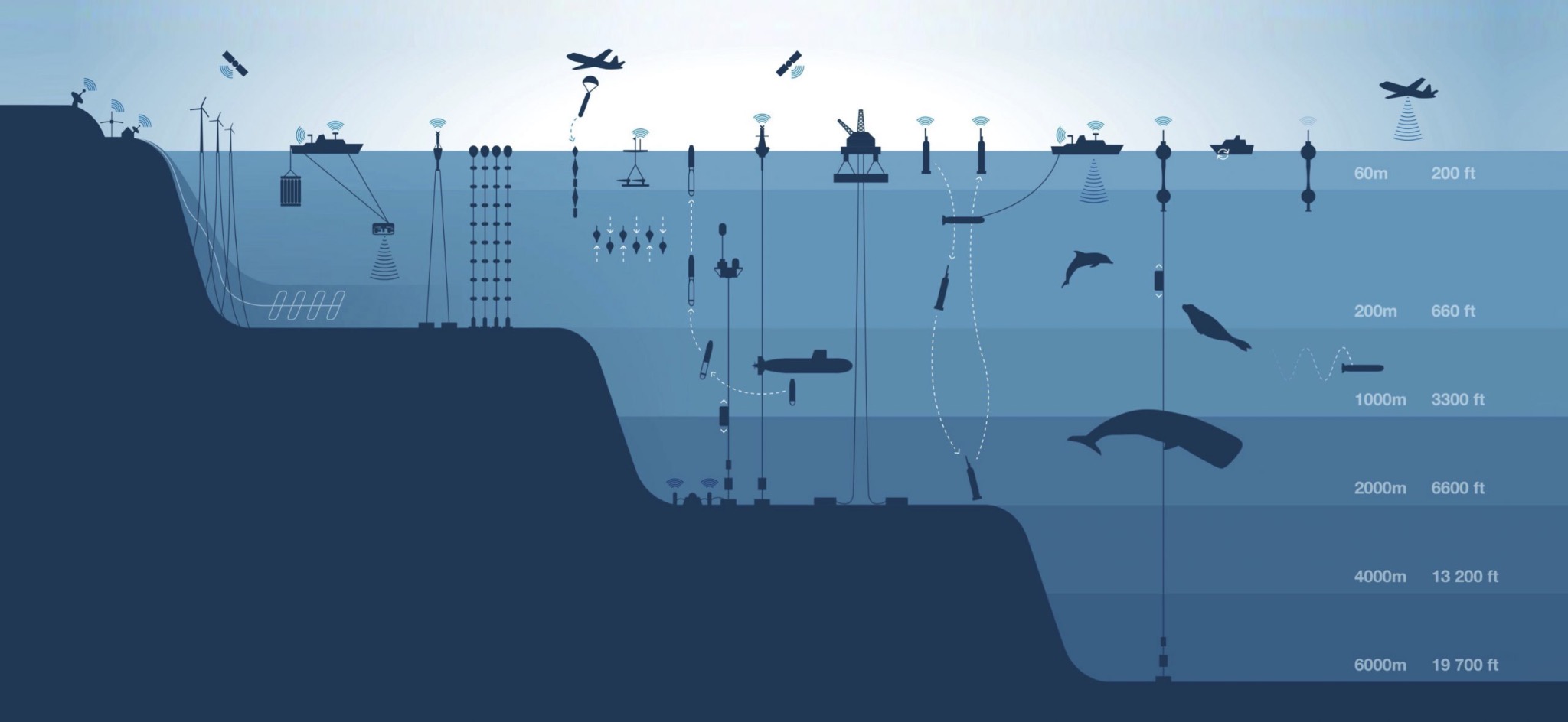
Ocean big data
Independent data generation and coordination with global ocean-observation systems.
New environmental frontiers
Monitoring to protect the environment, biodiversity and the resilience of marine ecosystems.
New frontiers of natural resources
Strategic information to understand and enhance the productive potential of the Argentine Sea.